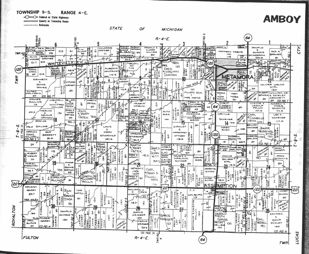
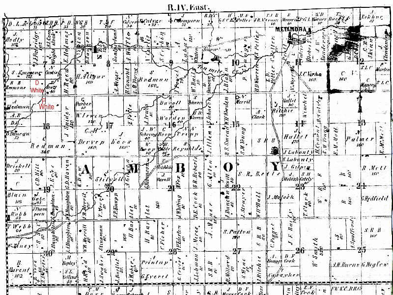
The land which was owned by the White family was actually south of
Whiteville and is shown in the second 1858 Platt Map with names in "red"
1858 Platt Map
Click "BACK" on your browser to return to White Family page.
1858 Platt Map
Click "BACK" on your browser to return to White Family page.